


7.6 km | 13 km-effort


Tous les sentiers balisés d’Europe GUIDE+


FREE GPS app for hiking
 SityTrail
IGN / Geographical institutes
SityTrail World
The world is yours!
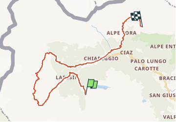
Trail On foot of 17.4 km to be discovered at Lombardy, Sondrio, Chiesa in Valmalenco. This trail is proposed by SityTrail - itinéraires balisés pédestres.
Sentiero Italia CAI 2019
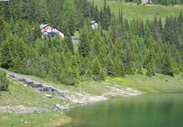
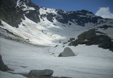
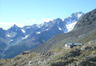
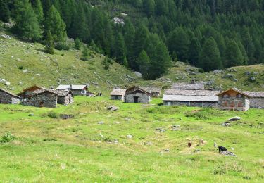
 Rifugio Gerli Porro all' Alpe Ventina - Rifugio Longoni - Photo 1")
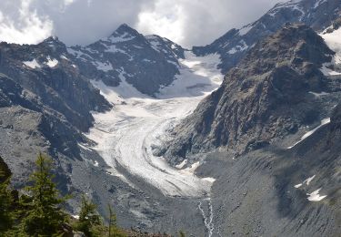
 Rifugio Gerli Porro all' Alpe Ventina - Rifugio Longoni - Photo 2")
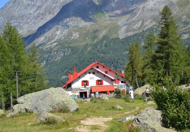
 Rifugio Gerli Porro all' Alpe Ventina - Rifugio Longoni - Photo 3")
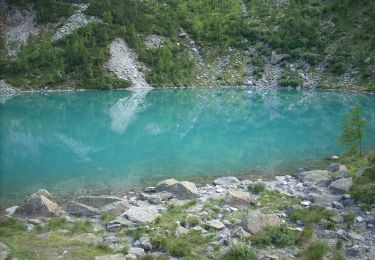
 Rifugio Gerli Porro all' Alpe Ventina - Rifugio Longoni - Photo 4")
 Rifugio Gerli Porro all' Alpe Ventina - Rifugio Longoni - Photo 5")
 Rifugio Gerli Porro all' Alpe Ventina - Rifugio Longoni - Photo 6")
 Rifugio Gerli Porro all' Alpe Ventina - Rifugio Longoni - Photo 7")
 Rifugio Gerli Porro all' Alpe Ventina - Rifugio Longoni - Photo 8")
 Rifugio Gerli Porro all' Alpe Ventina - Rifugio Longoni - Photo 9")
On foot
On foot
On foot
On foot

On foot
On foot
On foot
On foot

Walking